DJI Flight Records in Google Maps
by Clark Cheng
Summary
DJI drones automatically record detailed flight data during each mission, including GPS coordinates, altitude, speed, and more.
This information is saved as .txt flight log files on your mobile device when using the DJI Fly or DJI GO apps.
These logs are useful for reviewing flight paths, analyzing drone performance, and ensuring flight safety.
By converting these logs into the KML (Keyhole Markup Language) format, you can visualize your flights on Google Maps for easier tracking, sharing, or documentation.
Step-by-Step Instructions
-
Connect Your Phone to Your Computer
Use a USB cable to connect your device. -
Find DJI Flight Logs
Navigate to:
This PC\[Your Device Name]\Internal shared storage\Android\data\dji.go.v5\files\FlightRecord
(Note: Replacedji.go.v5if using a different DJI app.) -
Copy the Files
Locate the.txtfiles and copy them to your computer. -
Convert to KML Format
Go to phantomhelp.com/logviewer
Upload a flight log file and download the KML version after conversion.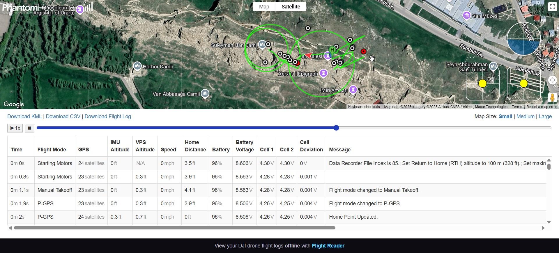
-
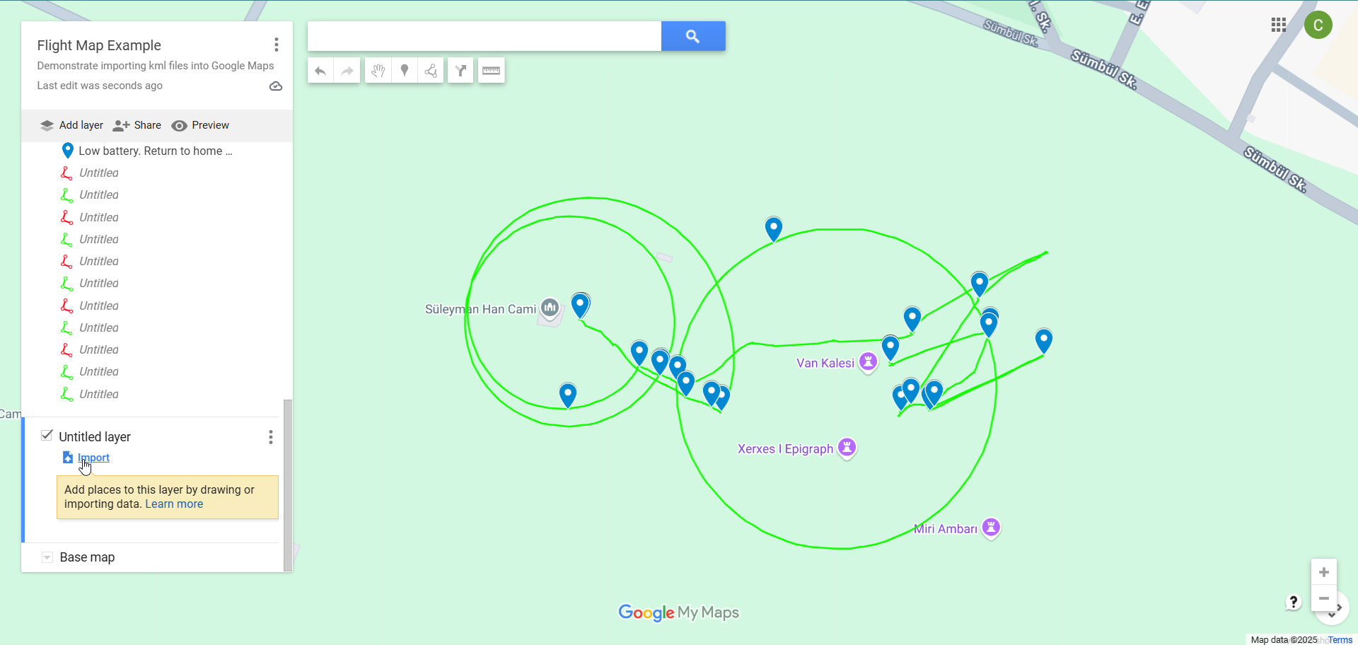
Open Google Maps
Visit maps.google.com -
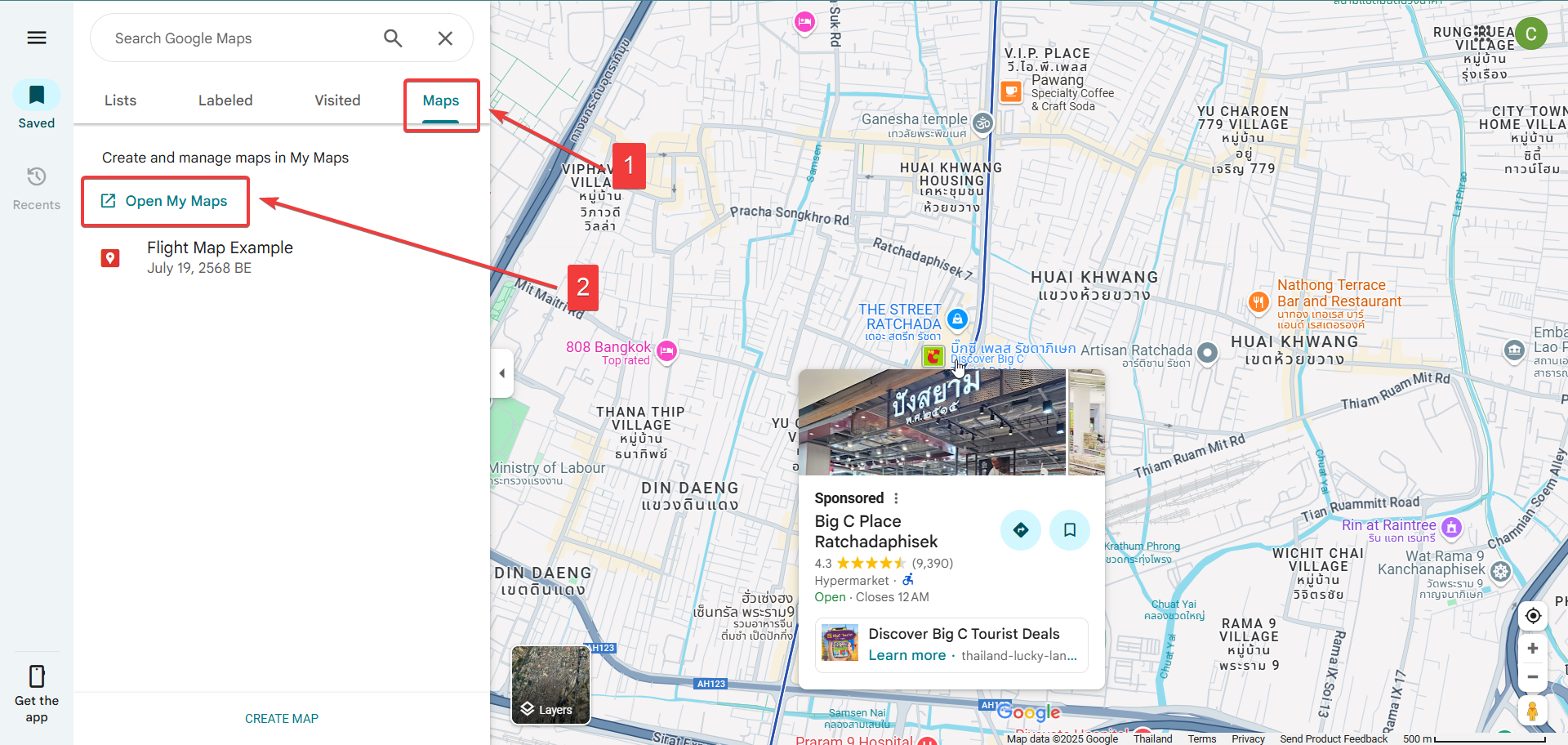
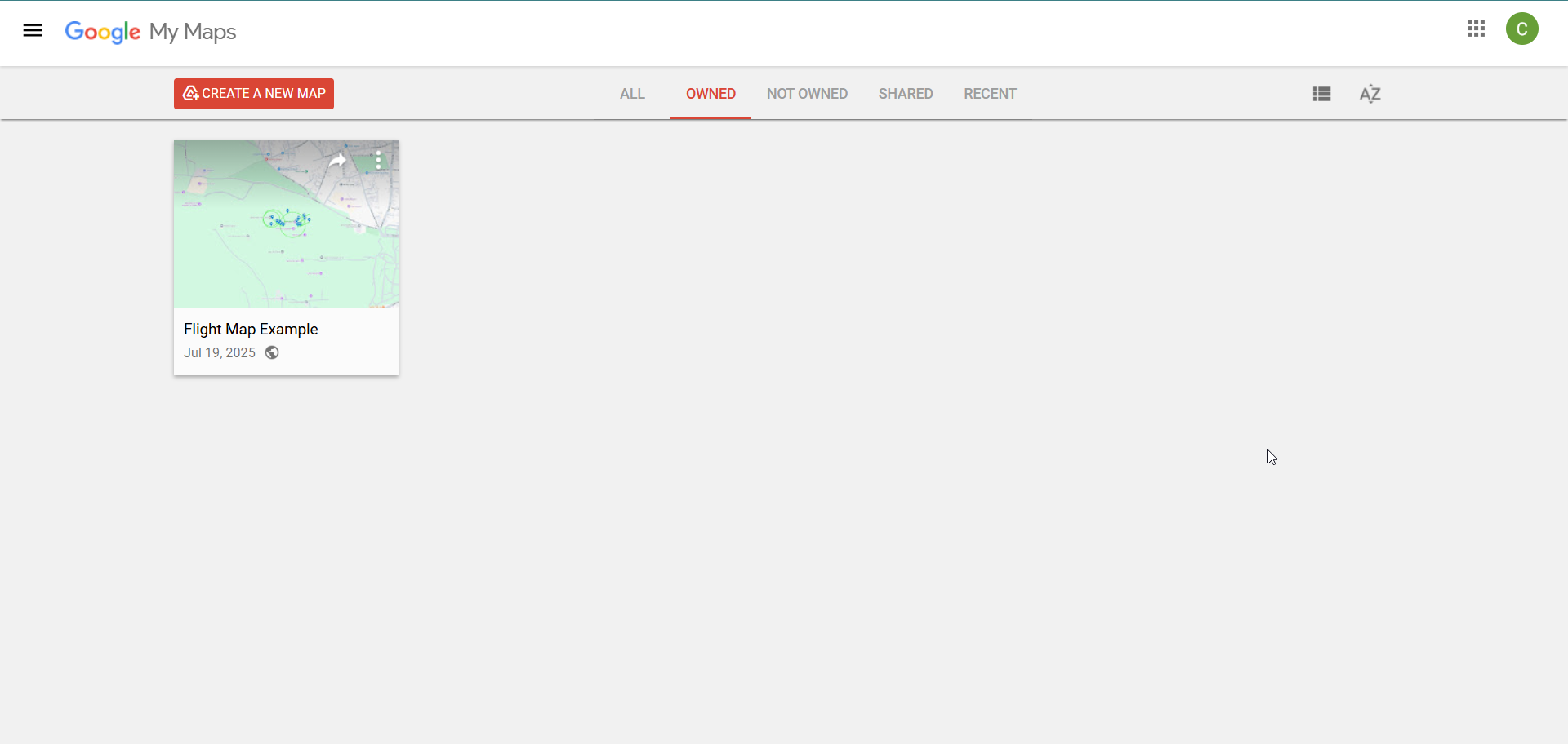
Import Your Flight Path
Click the Menu (≡) → Saved → Maps → Open My Maps.
Create a new map, name it, then click Import and upload your KML file.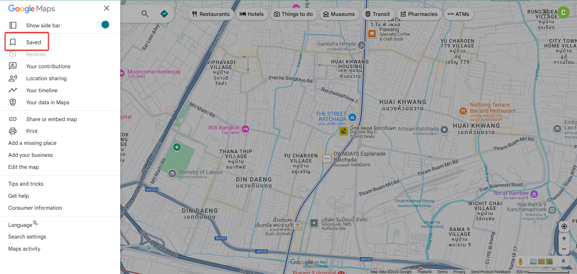
- Automatically sync flights from the DJI Fly/GO apps via their mobile app or manual uploads
- Visualize flight paths on satellite maps with altitude and telemetry overlays
- Monitor battery health, signal quality, and GPS strength over time
- Track pilot performance, flight duration, and airspace violations
- Generate detailed PDF reports for flight records, useful for commercial or regulatory documentation
Optional: Use Sites Like AirData UAV for More Detailed Analysis
In addition to Google Maps, you can upload your DJI flight logs to third-party services like AirData UAV. These platforms provide advanced analytics and cloud-based storage for your flight data.
With AirData UAV, you can:
These platforms are especially useful for drone professionals, inspectors, and hobbyists who want deeper insight and better record-keeping than Google Maps alone provides.